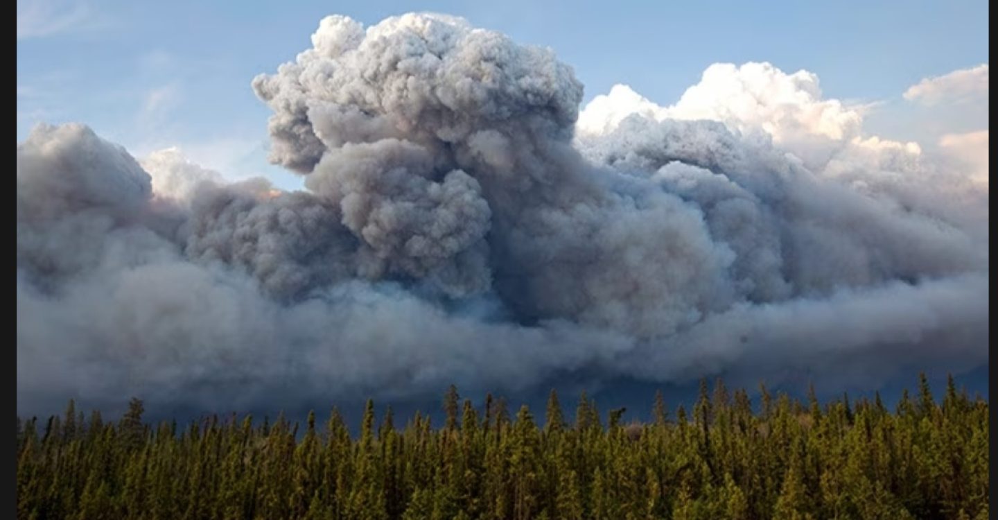
Cumulonimbus clouds form through moisture, unstable air, and an upward trigger. Warm air and water vapour rise rapidly, cool down, and condense into towering storm clouds, which are inherently unstable and potentially more dangerous in this water-laden, hotter climate. The classic anvil-shaped storm clouds are the brew-pots for lightning storms, hail and pluvial precipitation (pluvial flooding is caused by heavy rainfall overloading surface drainage). Extremely dry land, burned land, or land degraded through intensive farming are vulnerable to heavy rains which, while seen as welcome in bushfires, may even extinguish it before causing massive topsoil loss and land degradation.
https://sailing-blog.nauticed.org/how-cumulonimbus-form
Pyrocumulonimbus are an extreme version of cumulonimbus clouds, formed by the extreme heat of a bushfire or volcanic eruptions that force a rapid upward plume of hot air, smoke, ash, and moisture high into the atmosphere. Moisture bonds to smoke particles higher in the colder upper atmosphere, forming clouds. The plumes can soar 10-15 km. The rapid updraught causes a Cyclonic localised weather system. Characterised by unpredictable high winds at ground level, making conditions extremely hazardous for firefighters and evacuees and fanning the flames spreading the fire.
“Blazes near Madrid coming under control but efforts to contain huge fire near Bordeaux hampered by windy conditions while another heatwave forecast”
https://www.nytimes.com/2026/07/27/world/europe/pyrocumulonimbus-fire-cloud-france-wildfires.html
“Firefighters in France Encounter a ‘Fire Cloud’
A pyrocumulonimbus — a thundercloud created by intense heat — is a phenomenon that can spark new blazes and is “unprecedented in France,” officials said.
In the devastating wildfires in France, officials said that firefighters had encountered a dangerous phenomenon that many of them had not seen before: a pyrocumulonimbus, or “fire cloud.”
These large, fire-fueled thunderstorms, also known as pyroCbs, are created by intense heat from large blazes or volcanic eruptions. They produce lightning and burning embers that can spark more fires, and they generate high and unpredictable winds that fan the flames and spread the embers. But they rarely bring rain.”
“Fire Clouds rarely bring rain”, but the lightning they bring ignites new fires through lightning ground contact.
The collapse feals sporadic, unbalanced, slow in places faster in others 2°C by 2030, how bad does climate change need to get for some preppers to notice.
UPDATED..
https://youtu.be/k1_KFQIBGZc?is=tTySVwuqrRrfgsRT
